Instant Scoping, Smarter Documentation. magicplan Unveils Affected Areas
New AI-powered feature delivers instant, on-site damage calculations in a 3D environment
Efficient site assessment is the foundation of successful restoration projects. When documentation is precise, interactive, and immediate, contractors and technicians can leave the site with confidence, knowing they already have the answers needed to move work forward.
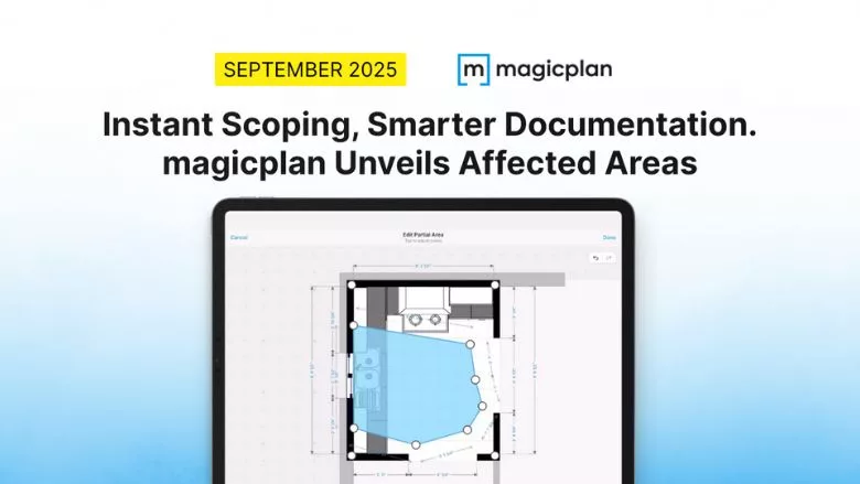
To address this challenge, magicplan has introduced Affected Areas, the latest addition to its AI-powered site assessment and scoping platform, trusted by thousands of restorers worldwide.
The new feature calculates damage in real time within an intuitive 3D environment directly on the device screen. Technicians leave the site with a complete, ready-to-use scope of work, turning every assessment into immediate progress. This functionality builds on existing capabilities, including photo capture with timestamps, video attachments, moisture level logging, and AI-assisted note recording during site walkthroughs.
What makes Affected Areas particularly powerful is its seamless integration into the broader magicplan ecosystem. Combined with 360° cameras, laser meters, and moisture meters, the platform continues to operate fully offline and instantly.
“Our new Affected Areas feature reflects our vision for the future of site assessment: effortless, precise, and immediate. By combining real-time 3D calculations with integrated documentation tools, we’re helping restoration professionals to focus on what matters most: delivering exceptional results for their customers,” said Andreas Boehm, CEO of magicplan.
With Affected Areas, inefficiency is eliminated. The result is clear, reliable documentation that drives projects forward without delays or missing details.
See magicplan Affected Areas in action in our latest video: https://youtu.be/2-0sRADWR-4
About magicplan
magicplan is the first real-time collaborative field documentation platform for restoration and claims professionals. By leveraging AI-powered spatial data capture, automated sketching, and seamless estimating, magicplan simplifies workflows, improves accuracy, and reduces costs. With millions of projects created worldwide, magicplan sets the standard for fast, flexible, and transparent field documentation. Learn more at www.magicplan.app.
Looking for quick answers on restoration, remediation and cleaning topics?
Try Ask R&R, our new smart AI search tool.
Ask R&R →
Looking for a reprint of this article?
From high-res PDFs to custom plaques, order your copy today!


