One of my favorite "hobbies" as a newbie journalist during my first gig out of college was "storm chasing." Living in the middle of nothing but cornfields in Northwest Indiana offered the perfect breeding ground for severe weather, and I was always quick to grab my camera and keep a close eye on the radar to get near the most intense spots I could find. Yes, it was a stupid hobby -- especially since I knew very little about weather, patterns, and didn't always have a plan in case conditions got too dicey.
Today, I understand a little more about weather and its patterns, and can see the link between restoration contractors understanding those patterns, and a greater ability to respond to hard-hit areas sooner. Now, I am not suggesting in the least that you "claim chase." I don't think you should be going up to someone's door moments after a tornado passes offering to fix someone's roof. However, if you are able to keep an eye on storms and weather patterns, you could still be the first to offer a helping hand to victims after the dust settles and the storm has fully passed.
Single-Cell | Pop-Up Storms
Not all thunderstorms are severe -- not all will have catastrophic results. For example, a single-cell or pop-up storm tends to be weak, and come and go within an hour. These are a normal occurrence in the heat of the summer.
Multi-Cell Storms
Storms that can produce damage are multi-cell, and form when cold and warm air collide. According to The National Severe Storms Laboratory, these are the storms that produce hail, strong winds, tornadoes, and flooding. However, not all multi-cell storms are severe! There are some more specific indicators of whether or not the storm system will pack a big punch or not.
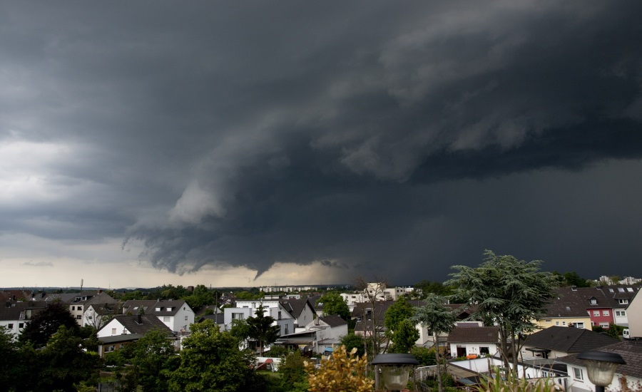
Supercell
Within that multi-cell storm, a supercell can form. Unlike most thunderstorm cells that die off in less than an hour, supercells are highly organized and last longer than an hour. These supercells tilt and rotate and can cover a 10 mile radius, and up to 50,000 feet into the sky. These supercells are where tornadoes happen, and many times you can see rotation of the cell on the radar before tornadoes form and touch down.
Bow Echo
Now, if you know there is a supercell nearby, take a look at the radar for something called a bow echo. This will look like a strong line of storms with a bend in the middle; it looks kind of like a comma. The greater the bow, the higher the winds likely are -- and tornadoes can occur on the leading edge.
What if there is storm damage?
If you've been watching the weather and the news and have some around-the-clock teams ready to respond to hard hit areas, don't go in like a bull in a china shop. Keep some cases on bottled water and snacks in your warehouse and send those with crews to the scene. Respond to human needs first before looking at the structural damage. Is everyone safe? Does anyone need medical help? Could you call in the Red Cross for some temporary housing or clothing?
Thinking about what you can do to help the victims before getting right down to business will help you build trust with potential future clients and customers. Remember, this industry is all about caring for people often during a traumatic event, so the more you are able to get to their level, the better.
Want to know more about thunderstorms and how to know what might be heading to your area? Check out this YouTube video!

Recent Comments
article review`
Agility
Information
Thanks for sharing this with us here....
Great Post. Thanks for sharing with us a...